About Aqua Map USA Marine GPS
An app to satisfy all your Fishing and Boating's needs, developed with the help of expert boaters. Download the best up-to-date Nautical Charts to safely enjoy the new boating season. With the Aqua Map Master transform...
An app to satisfy all your Fishing and Boating's needs, developed with the help of expert boaters. Download the best up-to-date Nautical Charts to safely enjoy the new boating season. With the Aqua Map Master transform your device in a real ChartPlotter.
►► Features:
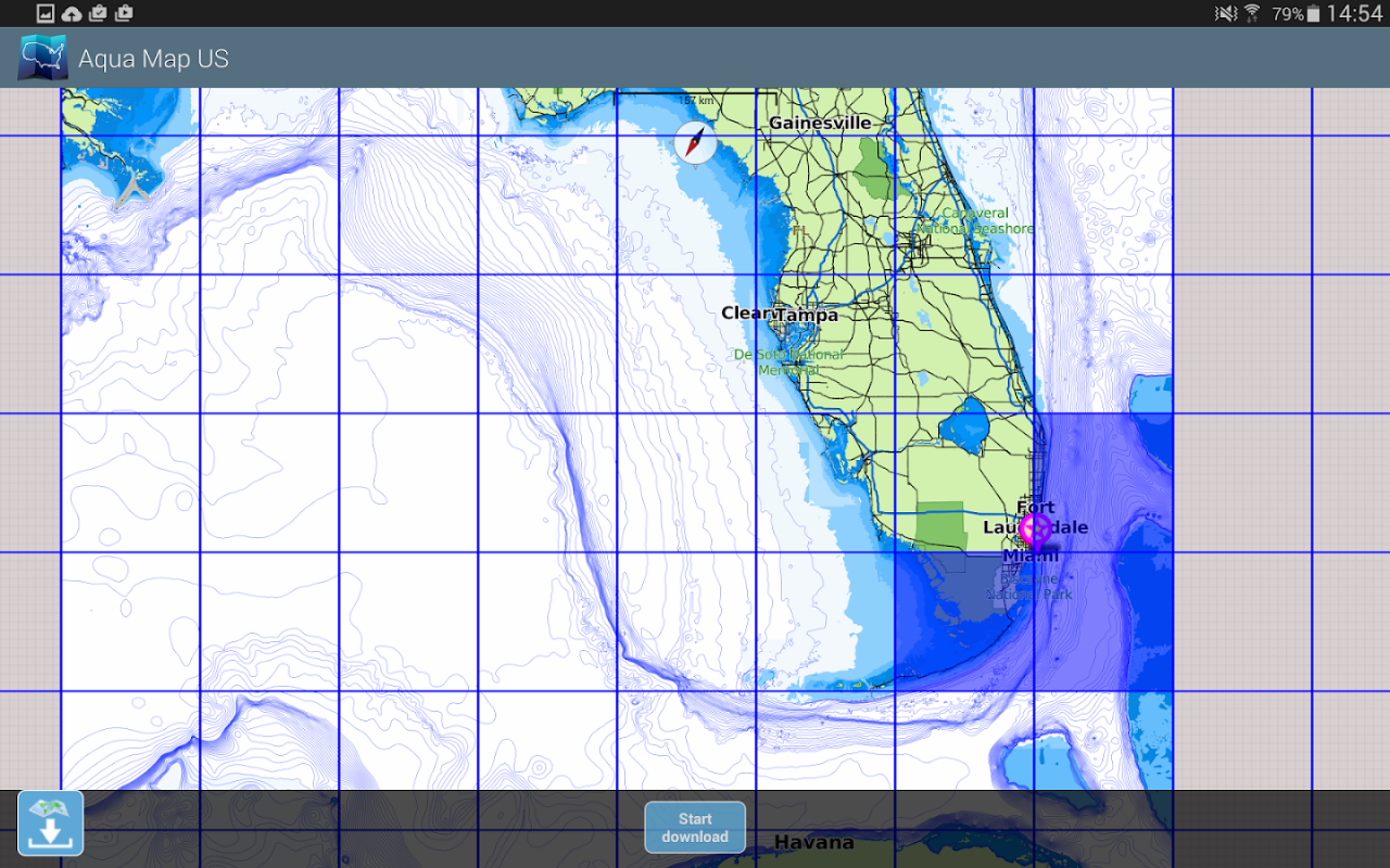
• Download the maps on the device for offline usage
• Plan and navigate your ROUTE with real-time information on next waypoint
• Anchor alarm with advanced configuration
• Tides & Currents prediction and simulation
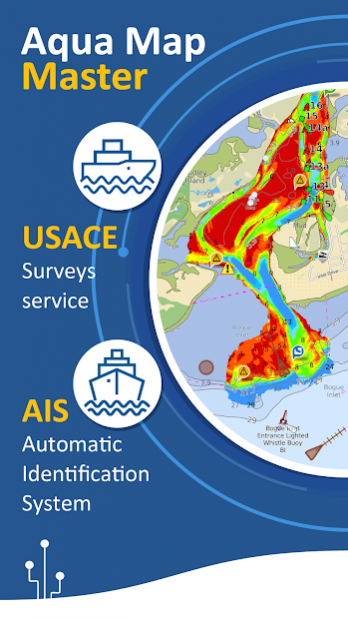
• Overlay the USACE surveys on top of your charts
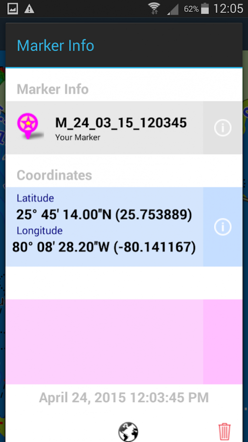
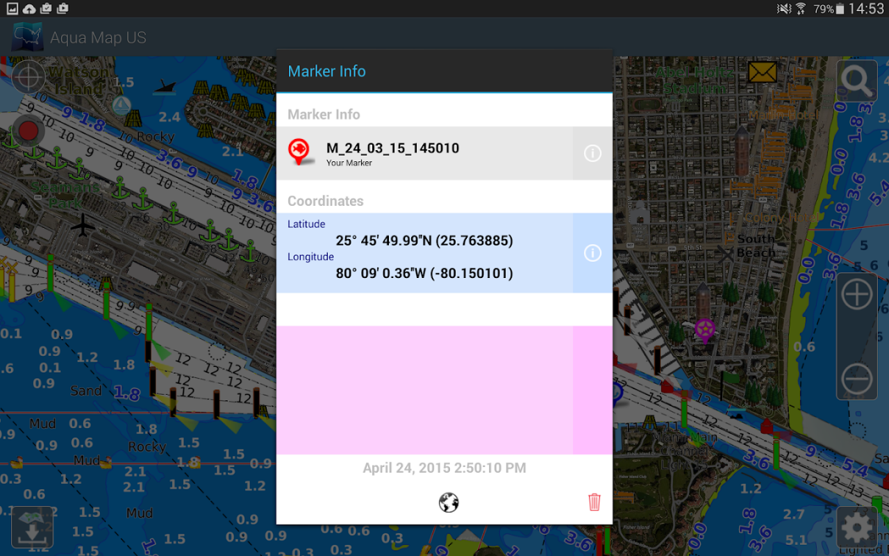
• Share and load tracks, markers and routes (KMZ and GPX)
• ActiveCaptain & Waterway Guide community integration
• Connect your NMEA devices through WiFi
• Powerful search with advanced settings
• Display AIS info from external devices with automatic collision detection
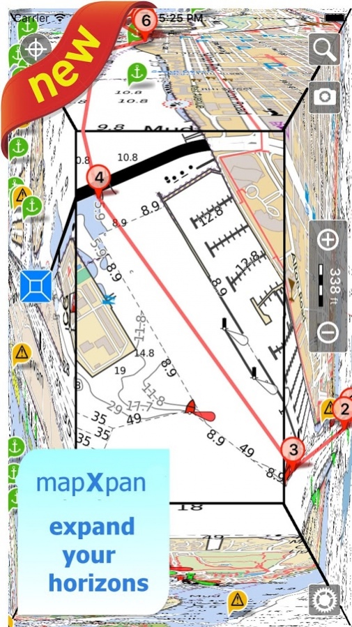
• Expand your horizons with mapXpan (patent pending)
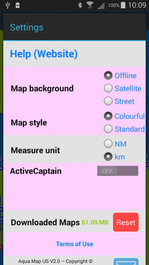
• Overlay the Satellite images on your map
• Measure distances on the map
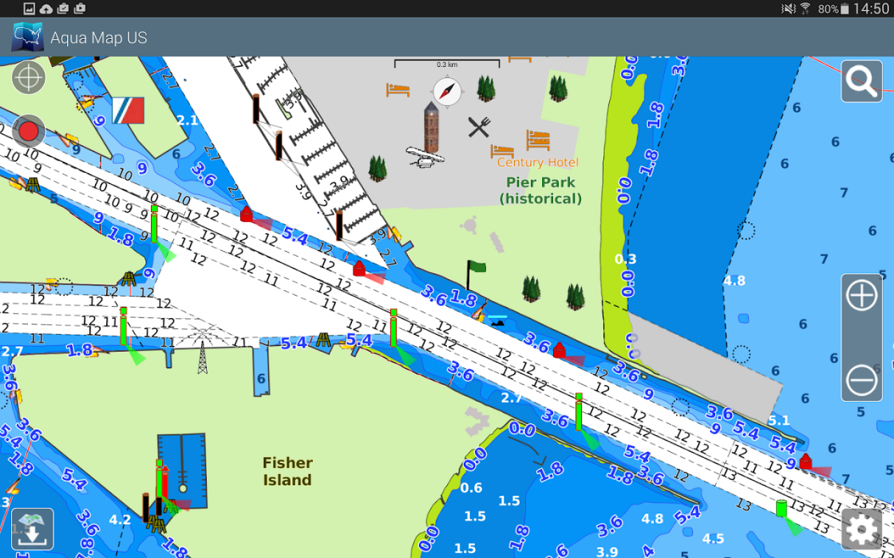
• Query map objects at your finger tip
► MAPS
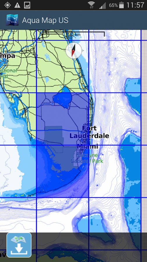
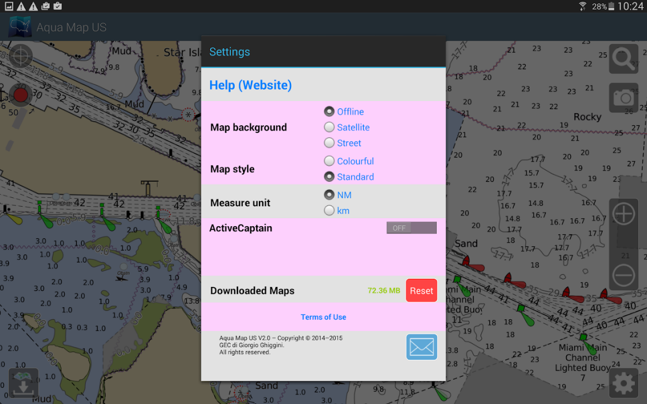
Aqua Map uses only official Nautical charts with depth contours, buoys, lights, etc. to enjoy the best boating experience. You can download the maps at home within your device and use them on the boat offline (no more Internet connection required). Our charts are derived in part from material obtained from: NOAA, CHS, BA, BSH, IIM, CNIG, AHS, NLHO, Explorer, etc.
Available areas: US, Canada, Bahamas, Caribbean, Bermuda, Brazil, Argentina, UK, Ireland, France Med, Spain, Portugal, Italy, Germany, Netherlands, Belgium, Croatia, Estonia, Malta, Australia, New Zealand, Seychelles, Maldives, Emirates, South Africa.
► ROUTES and WAYPOINTS
Plan your trip, insert and edit waypoints. Navigate your route and monitor distance, time (ETA) and direction toward your next waypoint or your final destination.
► ANCHOR ALARM
This function will check in realtime your GPS position against your anchor position previously defined. An acoustic and visual alarm will run as soon as your GPS position is out of the preferred range.
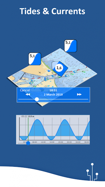
► TIDES & CURRENTS
You can calculate the prediction for more than 6800 stations in the US & Canada. You can also have a simulation of the T&C trend on the map.
► LOADING and SHARING
You can share your favorite's markers or send an email with your last daily track. Not only, you can also load any KML, KMZ, GPX (also zipped) found in internet or received from your friends.
► ActiveCaptain
Join the community of more than 100.000 boaters who write reviews, update data and provide up to date hazard information.
Read and contribute reviews and rating about marinas, shared local boating knowledge, anchorage and hazards
► Waterway Guide
Marinas, hazards, anchorages, bridges, free docks and much more to cover the entire US coastline.
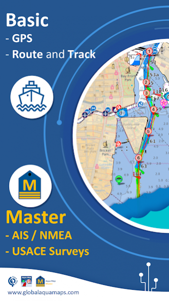
► Aqua Map Master
With this subscription you will access a set of advanced functions that will transform your device in a real ChartPlotter (.. and more).
Connect your NMEA devices through the WiFi and use their data for all the App functions (eg Anchor Alarm), download and display the last USACE surveys, display the AIS targets on the map with automatic collision detection.
► TYPE OF PURCHASES
- Unlimited: you can download and update your charts forever.
- Subscription: it is a one year auto-renewable subscription, it will automatically renews unless auto-renew is turned off at least 24-hours before the end of the current period. Subscriptions may be managed by the user and auto-renewal may be turned off by going to the user's Account Settings after purchase.
For more information please visit our website www.globalaquamaps.com
or send us an e-mail at
[email protected]
Previous Versions
Here you can find the changelog of Aqua Map USA Marine GPS since it was posted on our website on 2016-12-27 15:06:11.
The latest version is 8.4 and it was updated on 2024-04-23 10:46:28. See below the changes in each version.
Aqua Map USA Marine GPS version 8.4
Updated At: 2020-03-10
Changes: Improvements on NMEA string processing
Aqua Map USA Marine GPS version 8.2
Updated At: 2020-02-25
Changes: Improvements and bug fixing
Aqua Map USA Marine GPS version 8.0
Updated At: 2019-12-13
Changes: Fixed an issue with satellite images display
Aqua Map USA Marine GPS version 7.9
Updated At: 2019-12-06
Changes: . Aqua Map Master:
Use the Aqua Map Master functionalities to transform your device in a real Chart Plotter:
. Use and display information from external NMEA devices through WiFi
. Display AIS info from external devices with automatic collision detection
. Fixed an issue with boat orientation when the map is North up
Aqua Map USA Marine GPS version 7.8
Updated At: 2019-11-22
Changes: . Aqua Map Master:
Use the Aqua Map Master functionalities to transform your device in a real Chart Plotter:
. Use and display information from external NMEA devices through WiFi
. Display AIS info from external devices with automatic collision detection
. Various fixing and improvements
Aqua Map USA Marine GPS version 7.6
Updated At: 2019-10-12
Changes: . Various fixing and improvements
Aqua Map USA Marine GPS version 7.5
Updated At: 2019-09-02
Changes: . New Search function
. Graph of depths profile when available on track
. Various fixing and improvements
Aqua Map USA Marine GPS version 7.4
Updated At: 2019-06-10
Changes: . Added support for 64 bit CPUs
. Various fixing and improvements
Aqua Map USA Marine GPS version 5.2
Updated At: 2018-01-29
Changes: - Made possible to customize the line width for tracks and routes
- The route info gives now the estimated arrival time at the end and for each waypoint
- Tapping on a track the time of the touched track point is given in the track info window
- When the map is touched the list of all objects and user data in the touched point is presented
- It is possible to go center the map at coordinates manually entered by the user
Aqua Map USA Marine GPS version 3.0
Updated At: 2016-09-28
Changes: Added GPS info on main view: speed and direction when GPS is available,Added options for login to GEC Account. With a GEC account you can have an area for uploading and downloading your tracks and markers to and from our server and see the data also on a Desktop PC at home.,Bug Fixing